加都遺跡
| URL | https://sitereports.nabunken.go.jp/20190 | ||||||||||||||||||||||||||||||||||||||||||||||||||||||||||||||||
|---|---|---|---|---|---|---|---|---|---|---|---|---|---|---|---|---|---|---|---|---|---|---|---|---|---|---|---|---|---|---|---|---|---|---|---|---|---|---|---|---|---|---|---|---|---|---|---|---|---|---|---|---|---|---|---|---|---|---|---|---|---|---|---|---|---|
| DOI 2D code |
2D Code download
※二次元コードが有効化するまでにPDFの登録から2週間程度かかる場合があります。
|
||||||||||||||||||||||||||||||||||||||||||||||||||||||||||||||||
| DOI | http://doi.org/10.24484/sitereports.20190 | ||||||||||||||||||||||||||||||||||||||||||||||||||||||||||||||||
| For Citation | 兵庫県立考古博物館 2012 『兵庫県文化財調査報告422:加都遺跡』兵庫県教育委員会 | ||||||||||||||||||||||||||||||||||||||||||||||||||||||||||||||||
| 兵庫県立考古博物館 2012 『加都遺跡』兵庫県文化財調査報告422 | |||||||||||||||||||||||||||||||||||||||||||||||||||||||||||||||||
|
wikipedia 出典テンプレート :
{{Cite book ... 開く
|
|||||||||||||||||||||||||||||||||||||||||||||||||||||||||||||||||
| File | |||||||||||||||||||||||||||||||||||||||||||||||||||||||||||||||||
| Title | 加都遺跡 | ||||||||||||||||||||||||||||||||||||||||||||||||||||||||||||||||
| Participation-organizations |
 兵庫県教育委員会
- 兵庫県 兵庫県教育委員会
- 兵庫県
|
||||||||||||||||||||||||||||||||||||||||||||||||||||||||||||||||
| Alternative | かついせき | ||||||||||||||||||||||||||||||||||||||||||||||||||||||||||||||||
| Subtitle | 一般国道483号豊岡自動車道和田山八鹿道路事業に伴う埋蔵文化財発掘調査報告書 Ⅰ | ||||||||||||||||||||||||||||||||||||||||||||||||||||||||||||||||
| Volume | 3 | ||||||||||||||||||||||||||||||||||||||||||||||||||||||||||||||||
| Series | 兵庫県文化財調査報告 | ||||||||||||||||||||||||||||||||||||||||||||||||||||||||||||||||
| Series Number | 422 | ||||||||||||||||||||||||||||||||||||||||||||||||||||||||||||||||
| Author | |||||||||||||||||||||||||||||||||||||||||||||||||||||||||||||||||
| Editorial Organization |
兵庫県立考古博物館
|
||||||||||||||||||||||||||||||||||||||||||||||||||||||||||||||||
| Publisher |
兵庫県教育委員会
|
||||||||||||||||||||||||||||||||||||||||||||||||||||||||||||||||
| Publish Date | 20120321 | ||||||||||||||||||||||||||||||||||||||||||||||||||||||||||||||||
| Publisher ID | |||||||||||||||||||||||||||||||||||||||||||||||||||||||||||||||||
| ZIP CODE | 6508567 | ||||||||||||||||||||||||||||||||||||||||||||||||||||||||||||||||
| TEL | |||||||||||||||||||||||||||||||||||||||||||||||||||||||||||||||||
| Aaddress | 神戸市中央区下山手通5丁目10番1号 | ||||||||||||||||||||||||||||||||||||||||||||||||||||||||||||||||
| Report Type Codes |
埋蔵文化財(遺跡等)-発掘調査・分布調査・資料調査等
|
||||||||||||||||||||||||||||||||||||||||||||||||||||||||||||||||
| NII Type | Research Paper | ||||||||||||||||||||||||||||||||||||||||||||||||||||||||||||||||
| Research Report | 掲載されている(発掘調査報告書総目録の掲載対象) | ||||||||||||||||||||||||||||||||||||||||||||||||||||||||||||||||
| NCID | |||||||||||||||||||||||||||||||||||||||||||||||||||||||||||||||||
| JP Number | |||||||||||||||||||||||||||||||||||||||||||||||||||||||||||||||||
| Other Resource |
|
||||||||||||||||||||||||||||||||||||||||||||||||||||||||||||||||
| Remark |
調査番号:2002209
調査番号:2004181
調査番号:2005150
朝来市
表紙副書名 : 一般国道483号北近畿豊岡自動車道和田山八鹿道路事業に伴う埋蔵文化財発掘調査報告書Ⅰ
|
||||||||||||||||||||||||||||||||||||||||||||||||||||||||||||||||
| Articles | |||||||||||||||||||||||||||||||||||||||||||||||||||||||||||||||||
| Site |
|
||||||||||||||||||||||||||||||||||||||||||||||||||||||||||||||||
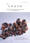
| Abstract | 縄文時代から鎌倉時代にかけての集落跡である。加都遺跡の北西端に位置している。地区名は宮ヶ田地区になる。縄文時代は後期の埋甕1基を検出しており、古墳時代は前期末から後期にかけての100棟を超す集落跡である。今回の調査でも9棟検出しており、土師器を主体部とした遺物が出土している。鉄製鋤先が出土していることは特筆される。鎌倉時代には掘立柱建物13棟や銭貨を伴う地鎮遺構を検出しており、中世比治庄に属している。 | ||||||||||||||||||||||||||||||||||||||||||||||||||||||||||||||||