松本市内その3 : 下神遺跡
| URL | https://sitereports.nabunken.go.jp/8167 | ||||||||||||||||||||||||||||||||||||||||||||||||||||||
|---|---|---|---|---|---|---|---|---|---|---|---|---|---|---|---|---|---|---|---|---|---|---|---|---|---|---|---|---|---|---|---|---|---|---|---|---|---|---|---|---|---|---|---|---|---|---|---|---|---|---|---|---|---|---|---|
| DOI 2D code |
2D Code download
※二次元コードが有効化するまでにPDFの登録から2週間程度かかる場合があります。
|
||||||||||||||||||||||||||||||||||||||||||||||||||||||
| DOI | http://doi.org/10.24484/sitereports.8167 | ||||||||||||||||||||||||||||||||||||||||||||||||||||||
| For Citation | 財団法人長野県文化振興事業団長野県埋蔵文化財センター 1990 『長野県埋蔵文化財センター発掘調査報告書6:松本市内その3 : 下神遺跡』日本道路公団名古屋建設局他 | ||||||||||||||||||||||||||||||||||||||||||||||||||||||
| 財団法人長野県文化振興事業団長野県埋蔵文化財センター 1990 『松本市内その3 : 下神遺跡』長野県埋蔵文化財センター発掘調査報告書6 | |||||||||||||||||||||||||||||||||||||||||||||||||||||||
|
wikipedia 出典テンプレート :
{{Cite book ... 開く
|
|||||||||||||||||||||||||||||||||||||||||||||||||||||||
| File | |||||||||||||||||||||||||||||||||||||||||||||||||||||||
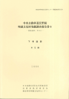
| Title | 松本市内その3 : 下神遺跡 | ||||||||||||||||||||||||||||||||||||||||||||||||||||||
| Participation-organizations | (一財)長野県文化振興事業団長野県埋蔵文化財センター - 長野県 | ||||||||||||||||||||||||||||||||||||||||||||||||||||||
| Alternative | まつもとしないその3 : しもかんいせき | ||||||||||||||||||||||||||||||||||||||||||||||||||||||
| Subtitle | 中央自動車道長野線埋蔵文化財発掘調査報告書6 | ||||||||||||||||||||||||||||||||||||||||||||||||||||||
| Volume | 6 本文編 | ||||||||||||||||||||||||||||||||||||||||||||||||||||||
| Series | 長野県埋蔵文化財センター発掘調査報告書 | ||||||||||||||||||||||||||||||||||||||||||||||||||||||
| Series Number | 6 | ||||||||||||||||||||||||||||||||||||||||||||||||||||||
| Author | |||||||||||||||||||||||||||||||||||||||||||||||||||||||
| Editorial Organization |
財団法人長野県文化振興事業団長野県埋蔵文化財センター
|
||||||||||||||||||||||||||||||||||||||||||||||||||||||
| Publisher |
日本道路公団名古屋建設局
長野県教育委員会
財団法人長野県文化振興事業団長野県埋蔵文化財センター
|
||||||||||||||||||||||||||||||||||||||||||||||||||||||
| Publish Date | 19900331 | ||||||||||||||||||||||||||||||||||||||||||||||||||||||
| Publisher ID | |||||||||||||||||||||||||||||||||||||||||||||||||||||||
| ZIP CODE | |||||||||||||||||||||||||||||||||||||||||||||||||||||||
| TEL | |||||||||||||||||||||||||||||||||||||||||||||||||||||||
| Aaddress | |||||||||||||||||||||||||||||||||||||||||||||||||||||||
| Report Type Codes |
埋蔵文化財(遺跡等)-発掘調査・分布調査・資料調査等
|
||||||||||||||||||||||||||||||||||||||||||||||||||||||
| NII Type | Research Paper | ||||||||||||||||||||||||||||||||||||||||||||||||||||||
| Research Report | 掲載されている(発掘調査報告書総目録の掲載対象) | ||||||||||||||||||||||||||||||||||||||||||||||||||||||
| NCID | |||||||||||||||||||||||||||||||||||||||||||||||||||||||
| JP Number | |||||||||||||||||||||||||||||||||||||||||||||||||||||||
| Other Resource |
|
||||||||||||||||||||||||||||||||||||||||||||||||||||||
| Remark | |||||||||||||||||||||||||||||||||||||||||||||||||||||||
| Articles | |||||||||||||||||||||||||||||||||||||||||||||||||||||||
| Site |
|
||||||||||||||||||||||||||||||||||||||||||||||||||||||
| Abstract | 887年(仁和3年)の『多武峯略記』に著された「信濃国筑摩郡蘇我郷字草茂症」に属すると推定される集落跡。初源は8世紀初頭で9世紀第1四半期から第3四半期に盛期を迎え廃絶する。9世紀段階は柵を伴う区画溝に囲まれた大型竪穴住居跡SB97が出現し、庄園経営を進める指導者の工房を兼ね備えた居宅の実態をとらえることができた。 | ||||||||||||||||||||||||||||||||||||||||||||||||||||||

